
Brahmagiri Mountain Range
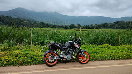
On a chilly morning, the much awaited ride to Irpu falls began. It started to drizzle after leaving the city limits, and by the time I reached Hunsur, it began to rain. After Hunsur at a Y junction, the road on the right leads to Kushalnagar, Madikeri. The left goes towards Virajpet, Kutta and eventually Kerala. On this Kutta route, a few kilometres ahead of Kutta, is a deviation towards Irpu Falls. Following the well-marked signboards, I reached the waterfall without using Google Maps.
Located within the Western Ghats, the Brahmagiri Wildlife Sanctuary borders Coorg and Wayanad in Karnataka and Kerala states, respectively. Formed by evergreen and semi-evergreen forests, shola grassland is found at higher altitudes. The valleys of these forests are home to diverse flora and fauna. The Malabar Banded Peacock is endemic to this region and thrives in the serene greenery. I marvelled, watching them glide from flower to flower, fluttering their vibrantly adorned wings.

Sit by the side of the stream and hear the water gurgling down, with the chirping of birds being the only other sound. It might be different if you go there during the peak time with scores of visitors. I was the second person to enter the sanctuary, so the tranquillity of the place was undisturbed. Built in the Kerala temple architecture, the Irpu Shri Rameshwara Swami Gudi looks tranquil. I wish it was open while I was there.
The cows in the foothills of Irpu are lucky to be grazing with the beautiful view of the mountain range every day. Envying them, I sat at one of the many small restaurants dishing up simple delicacies like dosa, idle and tourist-friendly poori, Maggi and fried rice. Relishing the piping hot dosa and freshly ground chutney, I enjoyed the view of the towering mountains as long as the skies remained clear. Bidding farewell to the beautiful region, I continued to the other side of the Brahmagiri mountain range - Thirunelly.
An entry fee of ₹50 per person takes you inside the sanctuary, and a short hike of less than a kilometre on the well-laid concrete road interspersed with 100 and odd steps leads to the magnificent waterfalls. There is a short iron bridge to cross the stream. The Lakshmantirtha River flowing from the mountains plunges from 52 metres to form the Irpu Falls. It gets its name from the hamlet - Irpu at the foothills of the mountain range. The heavy showers of the previous night and days contributed to the outflow.

Wayanad will remain my favourite region to ride, next to only Kudremukha. Wayanad has it all - the best tarmac, twists and turns, and pleasant weather. There is nothing more I can ask for. The chit-chat with the friendly Kerala police has become a ritual off-late. I must say, it is indeed refreshing. As soon as crossing the border, the butter-smooth roads with curves welcome you. Delighting in the irresistible smooth corners, I was at Thirunelly shortly. Sipping hot black tea - made with tea dust, ubiquitous in Wayanad, it was nice to be back in Wayanad with friendly people chatting over a cup of tea.
Instead of the usual main road going through the famous Kuttetan's Unniappam (Tholpetty Rd), I chose the interior road to reach Kattikulam and head back to Mysore through the Bavali - H.D.Kote route. This route offers some spectacular views of the surrounding mountain ranges. The other route takes you through forests with incredible curvy roads.

Wanting more butter-smooth curves, I grudgingly reached Bavali and entered the pothole-infested forest road through Nagarhole National Park. At a few vantage points on this route, the Kabini backwaters spread wide across are visible. A quick lunch stop at H.D.Kote and I was back in Mysore before tea-time. The road from Kutta to H.D. Kote and Hunsur goes through the heart of Nagarhole Tiger Reserve, which unfortunately doesn't allow two-wheelers.